
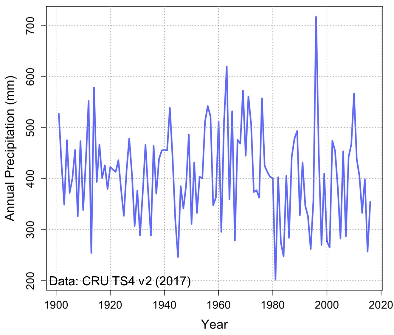
The Oum-Er-Rbia watershed is one of Morocco's major river basins in terms of agricultural production, hydroelectric capacity, industry and urban population. There, water is the key limitation to economic and social development. The region suffers from rainfall that is both low on average (about 350mm per year) and highly variable from year to year. This leads to frequent crop loss and makes efficient water planning difficult. Renewable freshwater resources are less than 1000 cubic meters per year per capita—well below the UN's scarcity threshold. On top of that, the area is at highest risk when it comes to climate change, between drastic precipitation decreases and uptick in heat waves and increased rainfall variability. Water management will become even more challenging in the near future, and agricultural policies should adapt accordingly.

The wet season in northwestern Morocco extends from November to April, with most of the rainfall occurring between December and February (DJF). This rain is brought by mid-latitude perturbations that formed over the North Atlantic ocean and were carried by high-altitude winds along the regional storm track. The position and strength of this track is mostly determined by the pressure pattern over the North Atlantic, which consists a large region of relatively high pressure centered over the Azores islands and one of low pressure region centered over Iceland. The change in relative strength of these high- and low-pressure areas is characterized by the North Atlantic Oscillation (NAO) index. The NAO is strongly linked to patterns of winter temperature, precipitation and storminess over the whole North Atlantic sector, and in particular over the Oum-Er-Rbia.
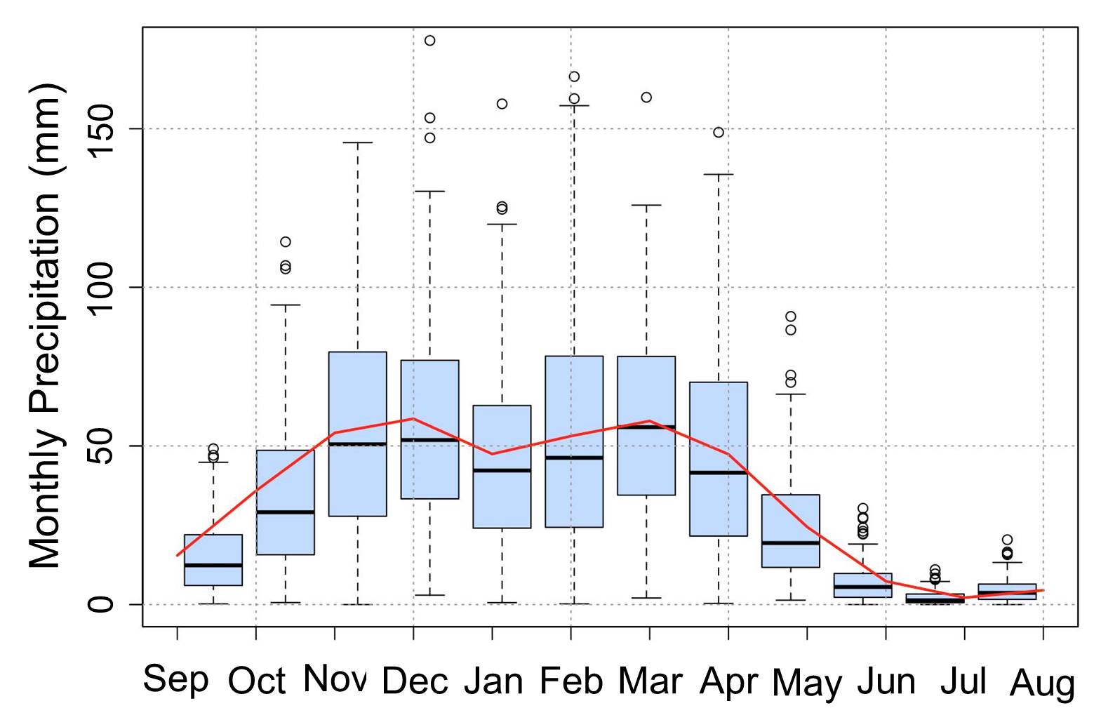
Annual cycle of precipitation over the Oum-Er-Rbia (data from CRU TS4).
Given its strong impact on agricultural productivity and the Moroccan economy (see impact of 2019 drought on national growth), skillful predictions of wintertime precipitation would be of enormous benefit to Morocco. Yet, in spite of the robustness of the connection between precipitation and the NAO, the low predictability of the latter makes it very difficult to issue forecasts of winter precipitation. Dynamical weather models have a hard time predicting the NAO at seasonal timescales, let alone Mediterranean precipitation. On seasonal time scales, however, Sea-Surface Temperatures (SSTs) are one of the dominant forcings of atmospheric circulation. We make use of clear patterns of mean North Atlantic and Pacific SST anomalies during months preceding relatively dry and relatively wet winters in northwestern Morocco, to predict rainfall months in advance and enable more efficient water management decisions. Overall, 30-40% of the inter annual variability can be predicted up to one month in advance (December 1st for DJF, January 1st for FMA).
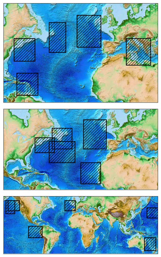
Selected predictors for November-January (top), December-February (middle), and February-April (bottom).
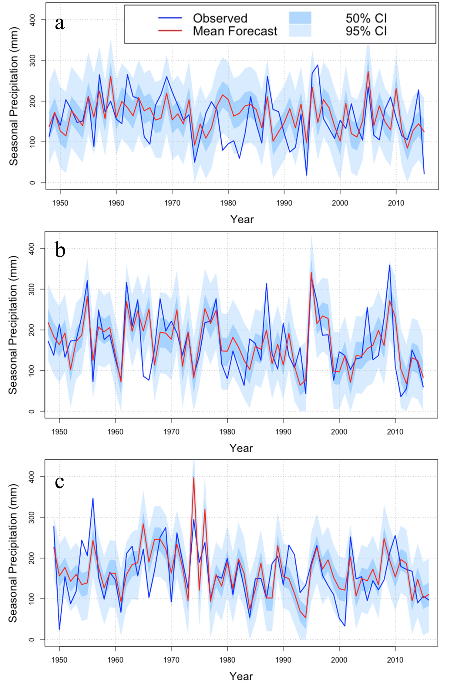
Annual mean forecasts and 95% confidence intervals for November-January (top), December-February (middle), and February-April (bottom).
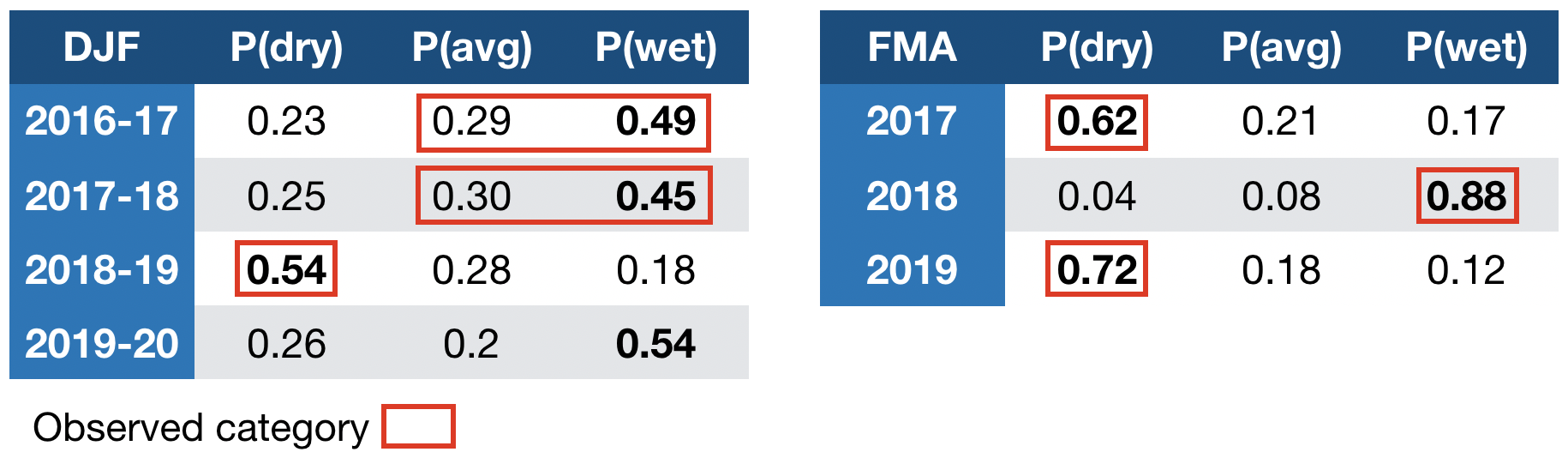
Current Forecasts:
A red box is drawn around the precipitation category that was observed a posteriori, as determined from TRMM V7 3B42 data. When two categories are indicated, it means that the observation was not sufficiently different from the cutoff value defining the corresponding category bound.
Data: The CRU TS4 precipitation data set is provided by the University of East Anglia’s Climatic Research Unit and is made available from their website at https://crudata.uea.ac.uk/ cru/data/hrg/. HadSST data are made available by the Met Office at www.metoffice.gov.uk/hadobs.
Reference: Tuel, A., & Eltahir, E. A. (2018). Seasonal precipitation forecast over Morocco. Water Resources Research, 54. https://doi.org/10.1029/2018WR022984